


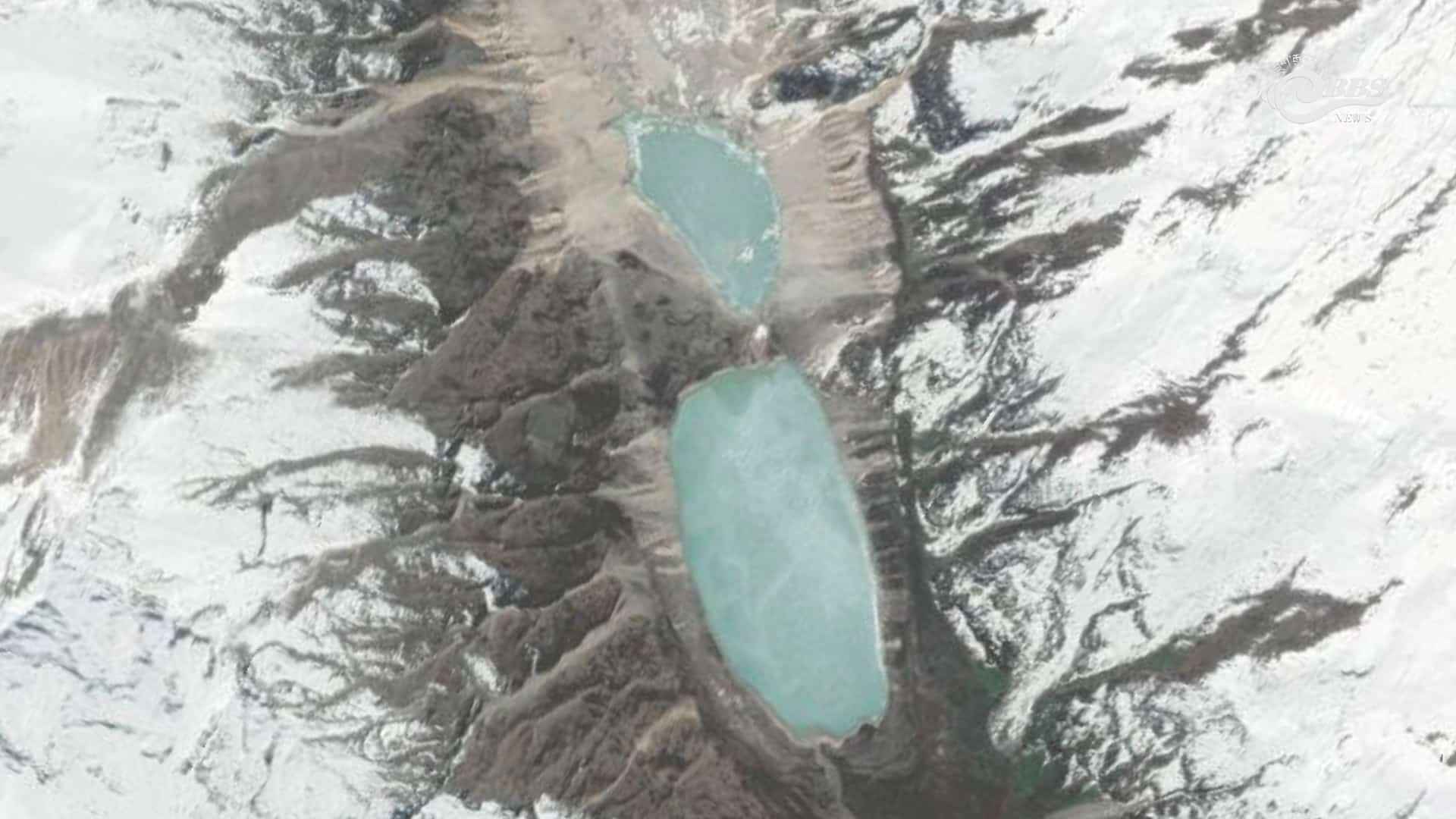
A satellite assessment by Noida-based geospatial intelligence company Suhora Technologies has found that the surface area of Bhutan’s Sintaphu Tsho has shrunk by 73 percent following the Glacial Lake Outburst Flood (GLOF) in late October, highlighting the scale of water released during the disaster and the continuing risks in the surrounding glacial landscape.
The assessment shows that the lake, also known as Shintaphu Lake, contracted from 24.13 hectares on October 28, shortly before the outburst, to just 6.54 hectares following the disaster.
Despite the dramatic reduction, an adjoining supraglacial lake remains substantially larger than its extent a decade ago, raising concerns about the potential for further instability in the area.
The findings provide an indication of the scale of changes to the glacial lake system following the outburst, which sent a massive surge of water and debris downstream through the Mo Chhu basin, washing away sections of the Punakha-Gasa highway and damaging local infrastructure.
Sintaphu Tsho, situated at an elevation of approximately 14,700 feet above sea level, had remained relatively stable over the past decade. Satellite observations between 2016 and 2026 show that its surface area increased only modestly, from 23.33 hectares to 24.13 hectares before the outburst.
The adjoining supraglacial lake, however, experienced a different pattern. Its surface area declined by 24.4 percent from 16.51 hectares following the disaster, but it remains considerably larger than its 2016 extent of 5.74 hectares.
Preliminary findings jointly analysed by the National Centre for Hydrology and Meteorology (NCHM) and the International Centre for Integrated Mountain Development (ICIMOD) indicate that the disaster was triggered by a cascading failure involving the two lakes.
Satellite observations, analysed with technical assistance from ICIMOD, suggest that the smaller upper lake breached first, sending a sudden surge of water into the larger lower lake. The additional inflow overwhelmed the lower lake’s moraine barrier, triggering the outburst and sending floodwaters downstream.
Before the breach, the two lakes held an estimated combined volume of six to seven million cubic metres of water. Approximately 4.89 million cubic metres were released during the cascading event.
The impact was not evenly distributed between the two lakes. Preliminary estimates indicate that the lower lake lost 81.53 percent of its water volume, with its depth declining by approximately 28 metres. The upper lake, however, experienced only a 5.39 percent reduction in volume, suggesting that a substantial amount of water remains in the upper basin.
The remaining water has made further assessment of the upper lake particularly important, as scientists work to understand the possibility of additional instability and potential downstream hazards.
However, difficult weather conditions and limited helicopter access have delayed comprehensive ground verification of the satellite findings. A joint technical team involving NCHM and disaster management officials has been mobilised to assess the site and verify the preliminary observations.
The authorities have some baseline information to support the investigation. NCHM specialists conducted a detailed field assessment of the Sintaphu lakes between May and June 2023, mapping the uneven lake beds, moraine barriers and glacier snout.
The earlier assessment provides valuable reference information against which scientists can compare the post-GLOF landscape and identify changes to the lake system and surrounding terrain.
The disaster has also highlighted gaps in the country’s glacial lake monitoring and early-warning infrastructure.
Unlike several glacial lakes in the Lunana region, which have monitoring systems in place, Sintaphu Tsho did not have real-time water-level sensors to track changes in lake conditions. The nearest active monitoring station was at Tatshe Makha, leaving authorities without direct real-time information on rising water levels at the lake before the outburst.
The absence of site-specific monitoring has renewed attention on the need to strengthen early-warning systems, particularly for glacial lakes that pose risks to downstream communities and infrastructure.
Meanwhile, the GLOF has created another potential hazard downstream. Flood debris blocked the river channel near Taktsimakhang, also referred to as Taktse Makha, forming a new artificial lake behind a natural landslide dam.
Although NCHM field observations indicate that water is currently draining through a continuous outlet channel, the stability of the debris barrier remains an important concern.
Any sudden failure of the natural dam could release accumulated water and trigger another flood downstream, potentially compounding the damage caused by the initial GLOF. Assessing the new lake, the stability of the debris dam and the remaining water in the upper basin are therefore key priorities for the ongoing investigation.
While the satellite assessment provides an important picture of the immediate changes following the disaster, authorities will need comprehensive ground assessments to establish the full extent of the damage and determine the risks that remain.
The 73 percent reduction in Sintaphu Tsho’s surface area illustrates the magnitude of the outburst. However, the remaining water in the adjoining upper lake and the newly formed landslide-dammed lake show that the threat may not be over.
For communities and infrastructure downstream, understanding these secondary hazards and strengthening monitoring and preparedness will be critical to reducing the risk of another disaster.
Tashi Namgyal, Thimphu